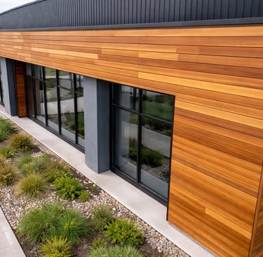
Site Mapping
High-resolution aerial site maps for planning, coordination, and visual reference — delivered quickly and accurately.
Service Overview
Our site mapping service captures high-resolution aerial imagery to produce clear, up-to-date visual maps of construction sites and land assets.
These maps are commonly used by builders, developers, project managers, and planners to understand site layout, track changes, coordinate trades, and support reporting — without relying on outdated plans or repeated site walks.
Clear top-down overview of the entire site
Ideal for planning, coordination, and reporting
Supports progress tracking and logistics planning
Fast turnaround with minimal site disruption
Our Process
1. Scope & site details
We confirm site boundaries, purpose of the mapping, resolution requirements, and any areas of focus prior to flight.
A compliant mapping flight is conducted using overlapping imagery to ensure complete site coverage and accurate visual context.
Final outputs are delivered digitally, organised and ready for planning, reporting, stakeholder updates, or internal documentation.
2. Aerial mapping flight
3. Delivery & review
Deliverables Included
✅ High-resolution JPG site map imagery.
✅ Orthomosaic-style top-down site overview.
✅ Clearly organised digital delivery.
✅ Mapping imagery aligned for comparison over time.
Optional Extras:
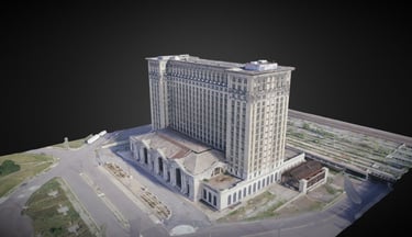
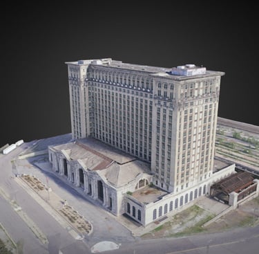
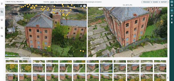
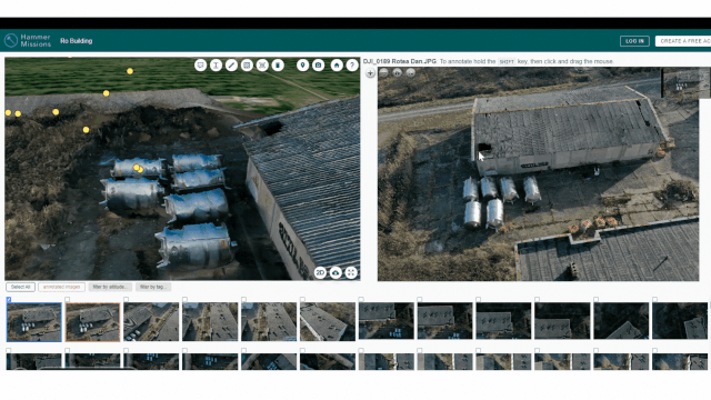
➕ Interactive 3D aerial site model
➕ Interactive 3D site walkthrough
Visual inspection only. No engineering certification or compliance sign-off provided.
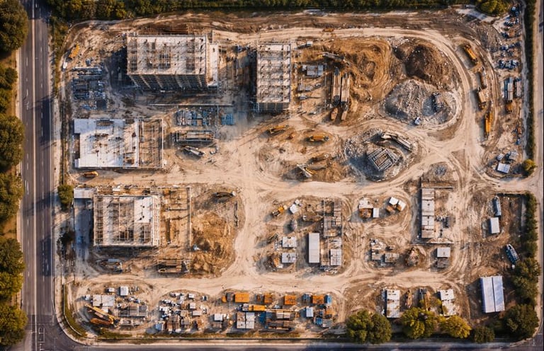
Sample Mapping Outputs
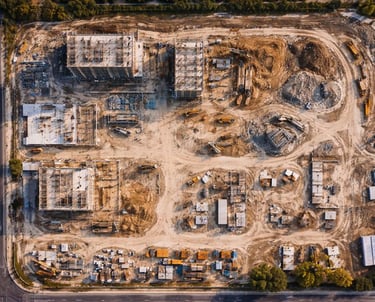
Top-down site overview
High-resolution aerial map showing site layout, access routes, structures, materials, and active work zones.
Visual reference imagery used to plan material storage, access routes, crane locations, and trade coordination.
A high-resolution 3D model generated from overlapping aerial imagery, providing spatial context and an interactive overview of the site.
Planning & logistics reference
Interactive 3D site models